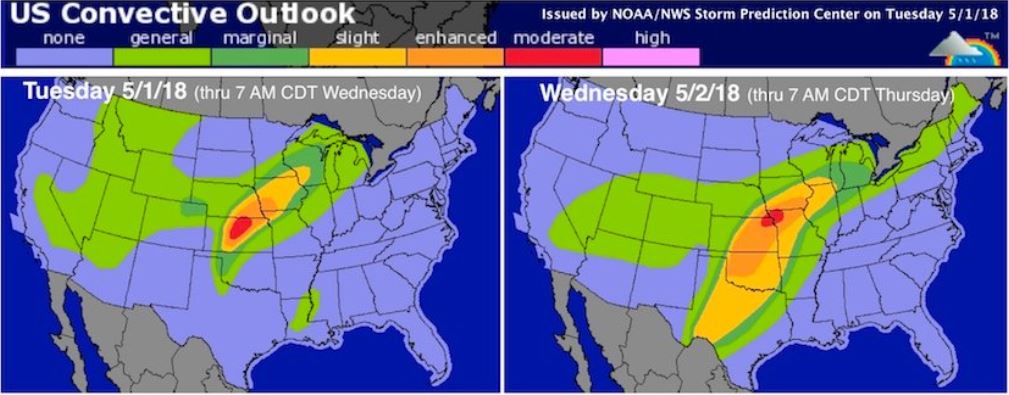
May is here and with it a round of severe storms that are expected to roll through the Central Plains and Mississippi Valley this week.
Today the risk is highest in central Kansas. The NOAA/NWS Storm Prediction Center has given a moderate risk status to the area- the second-highest of the severe weather threat categories used by SPC. We can expect the usual players for this type of system; hail, heavy rain, high winds and possibly tornadoes.
Tomorrow we can expect more harsh weather from the Great Plains into the Mississippi Valley. The storms will be more widespread, stretching from south Texas to Michigan. Parts of Oklahoma, Kansas, Missouri, and Iowa appear to have the greatest risk at this point. There is potential for tornadoes, very large hail, damaging winds, and localized flash floods.
On Thursday the threat shifts to Missouri and Illinois. High winds are likely, with less threat of large hail and tornadoes.
We have heavy client exposure throughout these areas, so if claims are generated we will have work! Time for adjusters to get packed and ready for storm season 🙂


