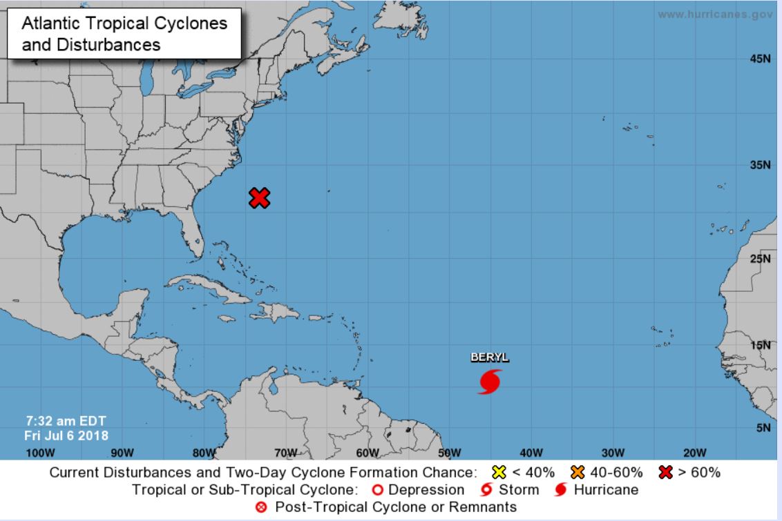
Hurricane Beryl has become our second named storm of the 2018 Atlantic hurricane season! The system will encounter conditions favorable for strengthening over the next day or so and then likely weaken to tropical storm status as it approaches the central Lesser Antilles late Sunday. Stormy conditions may be felt anywhere from St. Lucia, Martinique, Dominica, Guadeloupe and Antigua to the Virgin Islands, Puerto Rico and parts of Hispaniola
In addition, we have 96-L midway between the southeastern U.S. and Bermuda. Tropical storm formation could occur near the North Carolina coast Sunday or Monday.
The top forecast models are still somewhat in disagreement as to where the system will track and how intense it may be. Several models call for 96-L to come near the coast of southeastern North Carolina and then over the outer banks, but differ on intensity between tropical storm and hurricane status. We expect the models will more closely align over the next 24 hours or so and we will be able to get the most accurate picture of potential impacts. Should 96 reach tropical storm or hurricane status it will be named Chris.
We are watching both of these systems very closely and encourage adjusters to do so as well!


